This website uses cookies so that we can provide you with the best user experience possible. Cookie information is stored in your browser and performs functions such as recognising you when you return to our website and helping our team to understand which sections of the website you find most interesting and useful.
Star Project
The Star Project comprises two main mineralized occurrences, the formerly producing Star Point copper mine and the Star South Cu-Au-Ag prospect situated 2 kilometres to the south. Star consists of 199 lode mining claims located in Pershing County Nevada approximate 65 kilometers southwest of Winnemucca, Nevada on the east side of the Buena Vista Valley. The project area contains three identified targets defined by mapping, sampling and geophysical surveys including; ground gravity, airborne magnetic, airborne radiometric and ground Induced Polarization (IP) / Resistivity.
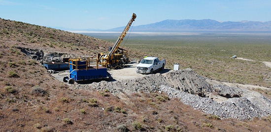
GTCH initiated the maiden drill program for the Star Project in early June, 2022. Three drill pads have been completed, one at Star Point and two at Star South, and the Company is excited to drill the first holes ever under the high grade surface mineralization.
In November 2020, GTCH released the results of the Induced Polarization (“IP”) geophysical survey at the Star Copper-Gold-Silver Project, which further identified and refined priority drill targets.
Key Highlights
- Four discrete anomalies, identified at Star Point copper and Star South Cu-Au-Ag occurrences, exhibit IP geophysical responses characteristic of porphyry style mineralization;
- Star Point has two pronounced low-resistivity high-conductivity anomalies that potentially reflect favourable target alteration and mineralization. One anomaly is coincident with a chargeability high, potentially a response to disseminated sulphides, while the other anomaly is structurally linked to the observed high-grade copper mineralization at surface;
- Star South has a prominent low resistivity anomaly that directly underlies the main high-grade Cu-Au-Ag showing and is considered a priority target. Located 600m northwest is a high resistivity anomaly bounded by chargeability anomalies that is potentially indicative of an intrusion fringed by sulphide mineralization
Star Point – The site of a historic near surface underground copper mining operation underlain by a magnetically defined intrusive rock. The IP-Resistivity survey conducted over the magnetically defined intrusion returned chargeability and resistivity highs. These geophysical responses are considered favourable, possibly reflecting intrusion related copper sulfide mineralization located below the surface copper oxide zone that was historically mined.
Star Point Drill Targets
A coincident low-resistivity high-chargeability anomaly is located 400 metres to the southwest of the Star Point copper mine occurrence in an area of high-angle structures similar to the ones observed at surface at the mineralized Star Point occurrence and represents a high priority target (Figure Line 12).
Approximately 500 metres to the northeast of Star Point a large low-resistivity zone has been identified. The most intense response appears bounded by high angle structures within an overall shallow angle bounding structure that trends upslope to the southwest and at its zenith truncates directly below the Star Point surface occurrence (Figure Line 12 and 13).
Star South – The historic artisanal shallow mining area contains surface copper-gold oxide mineralization (tenorite) along northeast trending faults and along the thrust fault boundary at the surface.
Star South Drill Targets
A prominent low resistivity zone crosses all three IP lines directly beneath the Star South showing. This anomaly closely correlates with low chargeability suggesting fluids associated with the mineralizing system has caused alteration to the original sulphides (Figure Line 3 and 11).
Approximately 600 m northwest of the Star South showing in an area of thin basin fill cover is a zone of high resistivity bounded by chargeability anomalies and is potentially indicative of the presence of a possible intrusion rimmed with sulphide rich material. An airborne magnetic high located to the southwest supports the concept of an intrusive center to a mineralized porphyry system (Figure Line 11).
The central drill target on the mine area is designed to test (shown in white) through the thrust fault into the top of the elevated chargeability and strong conductor, possibly a response from altered and mineralized argillite and carbonates. The western drill target is a follow-up hole (shown in white) to test the shallow and strong chargeability that more likely reflects lower plate carbonates located outside of the historic mine area and concealed under a gravel covers.
Star Point Cu Mine
The Star Point Cu Mine is the site of a historic, near surface, high-grade copper oxide (tenorite) mine that operated from the late 1940s through the mid-1950s. The ore produced was shipped to a smelter in Utah for processing, but there is no record of shipped tonnage or grade.
The historical development is focused on a 300 x 300 m area at the southern edge of a N-S trending promontory. The surface area is covered with various pits, portals, shafts, open cuts, and associated dumps. The underground development consists of several short shafts, winzes and tunnels of varying length leading to a series of stopes and drifts.
The high-grade copper mineralization is associated with quartz veins hosted within shear zones and the dumps contain numerous strongly mineralized specimens of malachite and azurite.
A surface sampling program was initiated in 2011, with the samples* primarily sourced from the dumps and to a lesser extent from outcrop. Of the 79 grab samples collected, 13 samples grade >0.5% Cu that include 9 samples grading >1% Cu. The higher-grade copper samples are associated with the main workings, with the highest reporting grades of 4.25, 3.00 and 2.35% Cu.
* The rock grab samples were collected during two separate sampling campaigns in 2011 by the current operator. The vast majority of the samples collected were sourced from the various mine-waste dumps populating the property and represent materials extracted from the adjacent workings. Of note, rock grab samples are by definition selective and not intended to provide nor should be construed as a representative indication of grade or mineralization at the Project. Grab samples are solely designed to show the presence or absence of mineralization, and to characterize the mineralization. The grab samples reported from the Project reflect a broad range in grade from below detection limit to the grades highlighted herein.
Samples were processed in two batches and analyzed at two certified analytical laboratory, ALS Global (“ALS”) in Reno and American Assay Laboratories (“AAL”) in Sparks, Nevada. Rock samples were processed similarly at both labs by drying followed by crushing so 70% passed through a 2mm screen. A 250g split, was then pulverized so that 85% passed through a 75μm screen. All samples were analysed for gold by standard fire assay using a 30g aliquot. Digestion of a 0.5g aliquot was done by Aqua Regia and finished by 39 element ICP-AES/MS at AAL or 51 element ICP-AES/MS at ALS. Samples with over limit silver, copper and lead were re-analysed and digested in assay grade Aqua Regia and finished by ICP-AES at ALS while over limit silver samples were re-analysed using a 30g aliquot by fire assay with a gravimetric finish at AAL.